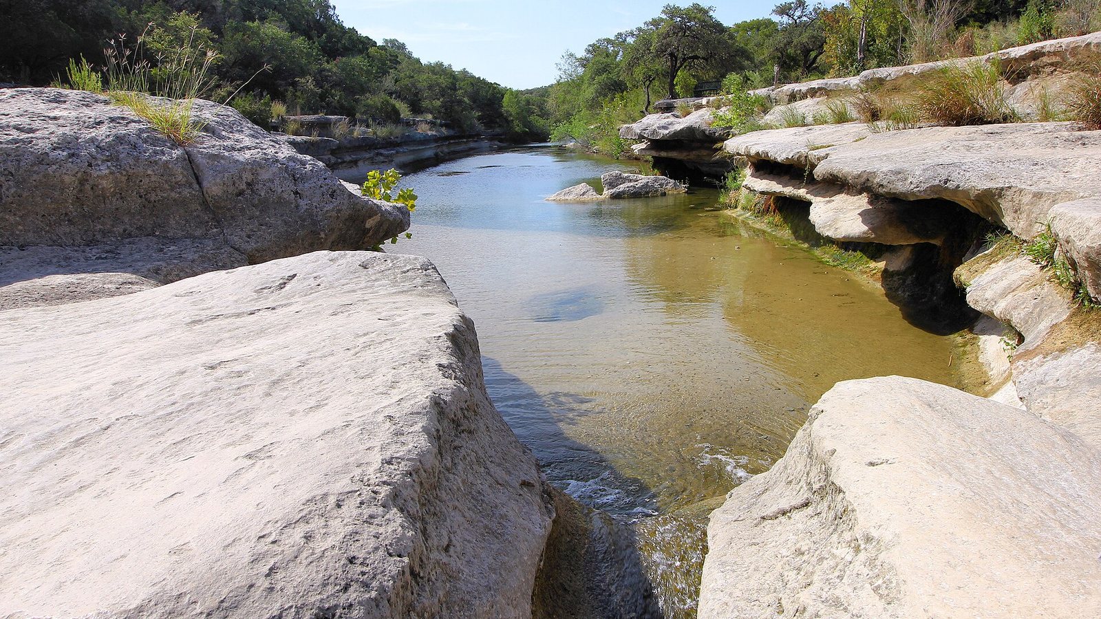
The best outdoor activities in Austin are close to downtown and mostly free: the 10-mile trail loop around Lady Bird Lake, the Barton Creek Greenbelt’s limestone canyon, the stairs up Mount Bonnell, a day in Zilker Park and the bats at sunset. Within half an hour you can hike McKinney Falls or Wild Basin, ride the car-free Veloway, or walk the gardens at the Lady Bird Johnson Wildflower Center. Farther out, the Hill Country opens up at Pedernales Falls and the Balcones Canyonlands refuge.
This guide is for visitors who want to spend part of a trip outside: walkers, hikers, runners, cyclists and anyone traveling with kids or a dog. The one caveat that matters is heat. The National Weather Service says normal highs in Austin stay at or above 90°F from May 26 to September 23, so from late spring to early fall the rule is simple: go at dawn, or go to the water. Trail lengths, hours, fees and closures below were checked on September 23, 2026 against the City of Austin, Travis County, Texas Parks and Wildlife, the U.S. Fish and Wildlife Service and the operators. For water-based plans, our guide to Austin swimming holes and lakes covers pools, paddling and tubing.
What’s closed or different right now?
- ACL Festival still holds Zilker Park. The Great Lawn is closed through October 18, as are most Zilker parking lots, with extra street closures on October 9-11. The Butler Trail, the Greenbelt, the disc golf course and the playscape stay open, but the Zilker Botanical Garden and UMLAUF Sculpture Garden close on the festival weekend.
- Butler Trail detours. On the north shore, expect detours near Rainey Street and I-35 (intermittent through January 2027), near The Confluence (through March 2027) and construction beside the trail near Brazos Street (through March 2027).
- Lake Austin drawdown, October 12 to November 30. The lake below Mount Bonnell will be lowered, which changes the view, and swimming at Emma Long Metropolitan Park is off-limits for the period.
- Burn bans. McKinney Falls State Park has had a burn ban since August 11, 2026, and Travis County parks are under one too. No wood fires.
- The Pennybacker Bridge overlook has no safe parking. There’s no official access to the cliff-top viewpoint on Loop 360, TxDOT’s roadwork there runs until late 2029, and the new layout will remove the shoulders people park on. See the bridge from Mount Bonnell or the water instead.
- Pet alert. Texas Parks and Wildlife has a statewide New World screwworm alert and asks visitors to check their pets often.
Austin’s outdoors at a glance
| Activity | Best place | Cost | Time needed | Best time |
|---|---|---|---|---|
| Easy walk or run | Butler Trail, Lady Bird Lake | Free | 1 to 3 hours | Sunrise; any season |
| Real hike | Barton Creek Greenbelt | Free | 2 to 4 hours | Spring and fall mornings, after rain |
| Best view for least effort | Mount Bonnell | No fee listed | 30 to 60 minutes | Sunset on a weeknight |
| Park day | Zilker Park | Free entry; some attractions paid | Half a day | Weekdays, outside festival dates |
| State park hike | McKinney Falls | $6 (13 and up) | Half a day | Fall to spring; reserve weekends |
| Quiet nature walk | Wild Basin Wilderness Preserve | Free weekdays; small weekend fee | 1 to 2 hours | Weekday mornings |
| Gardens and wildflowers | Lady Bird Johnson Wildflower Center | $15 weekdays, $18 weekends | 2 to 3 hours | Spring bloom; fall evenings |
| Cycling | The Veloway; Walnut Creek | Free | 1 to 3 hours | Early morning |
| Wildlife at dusk | Congress Avenue Bridge bats | Free | 1 hour | Sunset, spring into fall |
The best outdoor activities in Austin
Ranked for a visitor with limited time: the first five are in or next to central Austin and worth planning a day around; the rest reward a drive.
1. Walk or run the Butler Trail around Lady Bird Lake
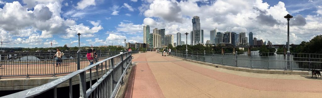
The Ann and Roy Butler Hike-and-Bike Trail is Austin’s favorite outdoor space, and the easiest to use: the City’s trail directory puts the full loop at 10.17 miles, mostly crushed granite, with the skyline on one side and the water on the other. You don’t have to do the whole thing. Bridges at Congress Avenue, First Street, Lamar Boulevard (the Pfluger Pedestrian Bridge) and elsewhere let you cut shorter loops, and the boardwalk section on the south shore, about 1.3 miles long, is open from 5 a.m. to midnight.
Weekend mornings are busy with runners, strollers, rowers and dogs, so keep right and call out when you pass. The lake itself is for paddling, not swimming, and our guide to swimming and paddling in Austin covers kayak and paddleboard rentals. Remember this fall’s north-shore detours.
Verdict: The one outdoor thing every visitor should do. Go at sunrise and walk from the Congress Avenue Bridge to the Pfluger bridge and back along the other shore.
2. Hike the Barton Creek Greenbelt
The Greenbelt is a wooded limestone canyon that runs from Zilker Park into the southwest hills, with 12.68 miles of trail in the City’s directory and a 7.5-mile main trail. It’s Austin’s best real hike: rocky, shaded in stretches, with bluffs, climbers and, after rain, swimming holes like Twin Falls and Sculpture Falls. It’s also where visitors most often underestimate conditions. Water levels depend on recent rain and can change quickly and without warning, there’s little or no lighting, and trash cans sit only at trailheads.
Pick your entrance by what you want. The Zilker trailhead at 2212 William Barton Drive has a parking lot at the lower end. The 360 Trailhead on the Loop 360 northbound frontage road has a free lot and composting restrooms. The Gaines Park/MoPac access has limited free street parking and leads to Twin Falls, and Trail’s End at 1712 Camp Craft Road reaches the upper section, with street parking paid daily from 8 a.m. to 8 p.m. Dogs must be on a leash 6 feet or shorter, and the City recommends against road and cruiser bikes on the rough surface.
Verdict: The best hike in the city in spring or fall. In July and August, start at first light and bring more water than you think you need.
3. Climb Mount Bonnell for the view
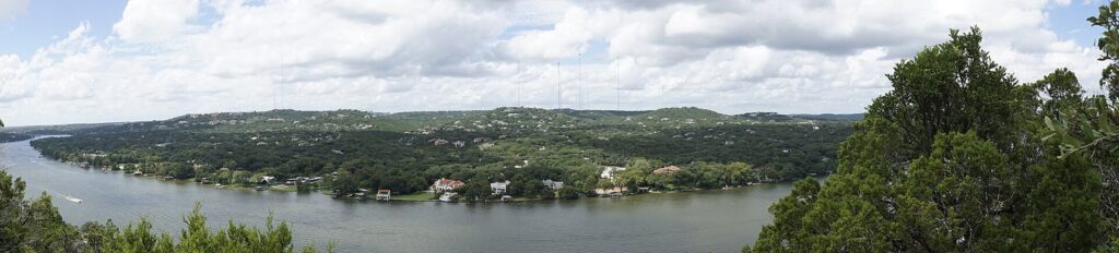
Mount Bonnell, in the 5.36-acre Covert Park at 3800 Mount Bonnell Road, is what the City calls a 784-foot-high promontory along Lake Austin, a figure that’s elevation above sea level rather than height above the water. A short, steep staircase takes you to the top, where Lake Austin bends below between wooded bluffs and big lakeside houses. The park is open daily from 5 a.m. to 10 p.m., and the City lists no fee. Sunset is the classic time, and the crowd knows it, so a weeknight or an early morning is calmer.
From the top you can see toward the Pennybacker Bridge on Loop 360, which is the safe way to enjoy it: the famous cliff-top overlook beside the bridge has no official parking, and TxDOT’s roadwork there will remove the highway shoulders people have been parking on.
4. Spend a day in Zilker Park
Zilker is Austin’s front lawn, with more than 350 acres across the lake from downtown, open from 5 a.m. to 10 p.m. like other City parks. Entry is free, and a full day can mix free and paid things: Barton Springs Pool ($9 for a non-resident adult), the 28-acre Zilker Botanical Garden ($8 for non-resident adults, open 9 a.m. to 5 p.m. from September to May), the UMLAUF Sculpture Garden ($8), the Zilker Eagle mini train ($6 plus tax, Friday through Tuesday), a disc golf course, a playscape and the Greenbelt trailhead at its western edge. The new Mile Zero trailhead for the Violet Crown Trail opened in the park in fall 2025.
Parking is free on weekdays and $3 an hour on weekends and holidays from spring break through Labor Day. The catch this month is ACL Festival: the Great Lawn and most lots stay closed until October 18.
A few details make a Zilker day smoother. The botanical garden keeps summer hours of 8 a.m. to 4 p.m. from June through August and 9 a.m. to 5 p.m. from September through May, with last entry half an hour before closing, and its main lot off Barton Springs Road is free, first come, first served. The Zilker Eagle runs Friday through Tuesday from 10 a.m. to 5:45 p.m., pauses daily from 1:30 to 2:30 p.m., and sells tickets only in person at the depot on the day; children under 2 ride free.
5. Watch the bats at the Congress Avenue Bridge
From spring into fall, a huge colony of Mexican free-tailed bats pours out from under the Ann W. Richards Congress Avenue Bridge around sunset. Watch from the bridge sidewalk, the lawn on the southeast bank, the lake trail or a boat or kayak. It’s free and takes about an hour, including the wait. Don’t shine white lights at the bats or make loud noise near the bridge, and never touch a bat, even one on the ground.
6. Hike McKinney Falls State Park
McKinney Falls, 13 miles from the Capitol at 5808 McKinney Falls Parkway, puts Hill Country scenery inside the city limits: limestone ledges on Onion Creek at the Upper and Lower Falls, cypress-lined banks and trails through the woods. Entry is $6 for anyone 13 and older, and kids 12 and under are free. The park says day passes sell out every weekend and holiday, so reserve online or at (512) 389-8900. The gate opens from 8 a.m. to 10 p.m. Swimming is allowed in the creek when conditions allow, and camping is available at 81 sites with hookups, but no wood fires under the current burn ban. The visitor center opens Tuesday through Thursday from noon to 4 p.m. and Friday through Sunday from 9 a.m. to 4 p.m. At the Upper and Lower Falls, food, alcohol, glass, coolers, speakers and hard balls are banned, so save the picnic for elsewhere in the park.
7. Walk the trails at Wild Basin Wilderness Preserve
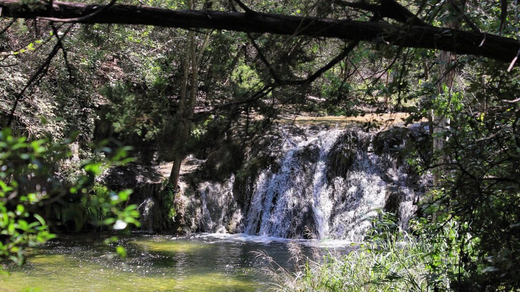
Wild Basin is the antidote to a crowded Greenbelt: a small, quiet preserve off Loop 360, about a mile north of Bee Caves Road, owned and run jointly by Travis County and St. Edward’s University. About 2.5 miles of trails wind through juniper and oak to an overlook and a creek with a waterfall after rain. On weekdays there’s no fee and no reservation; on weekends and federal holidays you need a reservation and pay a small entrance fee. Trails open from sunrise to sunset, and no dogs or other pets are allowed.
Verdict: Perfect for a weekday morning when you want birdsong instead of crowds.
8. Visit the Lady Bird Johnson Wildflower Center
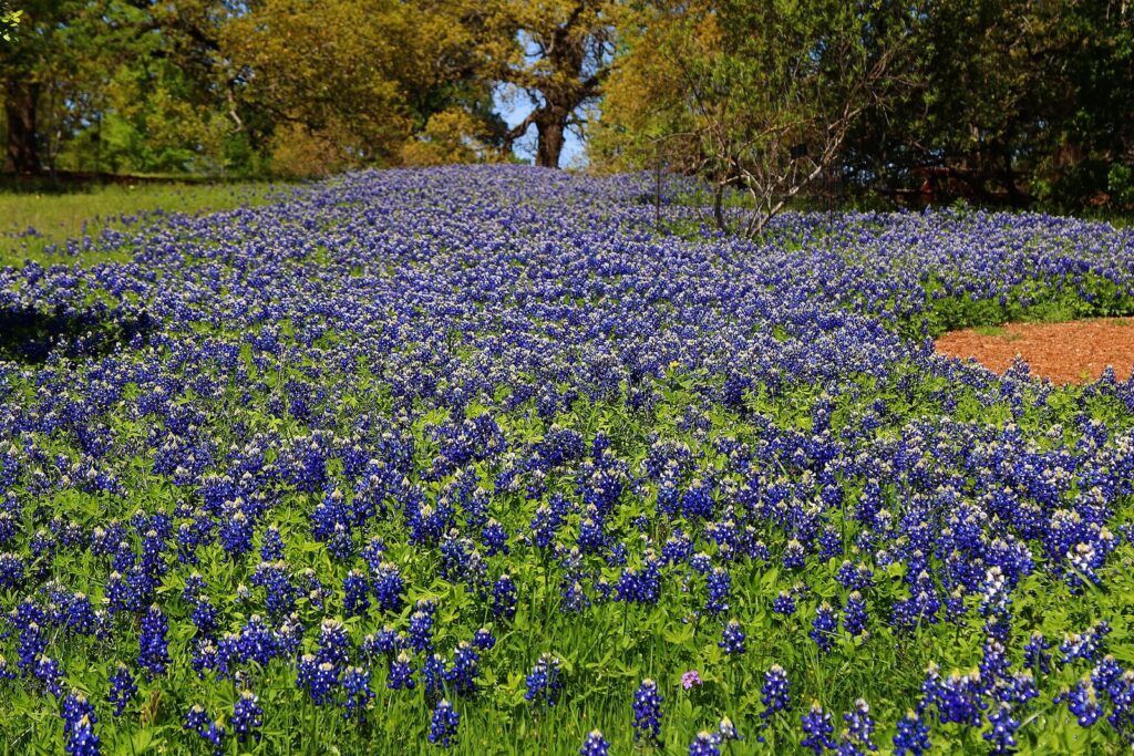
The Wildflower Center covers 284 acres of native gardens and trails at 4801 La Crosse Avenue in southwest Austin. It’s part of UT Austin and bills itself as the Botanic Garden of Texas. General admission is $15 for adults Monday through Thursday and $18 Friday through Sunday, it takes credit cards only, and parking is limited, so the center suggests carpooling or rideshare at peak times. Only service dogs are allowed.
Spring is the famous season, when bluebonnets and other wildflowers peak, but fall has its own draws. Tuesday Twilights, with late hours, live music and food trucks, run on Tuesdays from September 22 to November 10 ($15 for adults), and Fortlandia, its outdoor fort exhibit, opened for its ninth year on October 1. The café is closed for remodeling, so bring snacks. The center closes on Thanksgiving, December 18, December 24 and 25, December 31 and January 1.
9. Ride the Veloway or the Walnut Creek trails
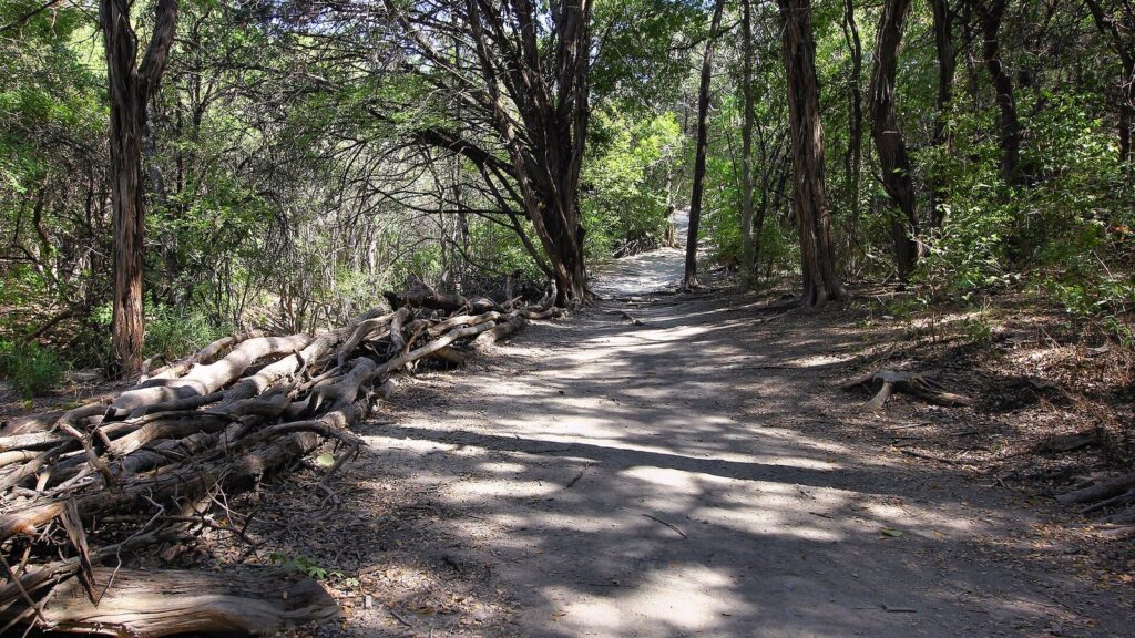
Two City parks make cycling easy. The Veloway at Circle C Ranch Metropolitan Park, 4900 La Crosse Avenue, next door to the Wildflower Center, is a 3.11-mile paved loop reserved for bikes and inline skates, with no cars and no walkers, which makes it the safest place in Austin for a steady road ride or a child learning on training wheels. For dirt, Walnut Creek Metropolitan Park at 12138 North Lamar Boulevard has the 5.32-mile Walnut Creek Metropolitan Park Trail plus a 10-mile intermediate trail, both shared by hikers and riders.
Don’t have a bike? CapMetro Bikeshare’s $10 day pass covers unlimited 30-minute rides on its e-bikes around the central city, including the lake trail. Our guide to getting around Austin covers bikeshare, bike lanes and the bus.
10. Meet the peacocks at Mayfield Park
Mayfield Park and Nature Preserve, 23 acres at 3505 West 35th Street, across from the road up to Mount Bonnell, is home to a free-roaming flock of peafowl, walled cottage gardens and short nature trails. It’s open daily from 5 a.m. to 10 p.m., and the City lists no fee. The walled gardens are open when they aren’t rented for events, most often Monday through Thursday. Don’t touch, feed or chase the peacocks, and leave dogs at home: pets aren’t allowed.
11. Hike Pedernales Falls State Park
About 30 miles west of Austin, Pedernales Falls is where the Pedernales River spills over broad, tilted limestone ledges. Trails range from the 0.5-mile Twin Falls Nature Trail to the 6-mile Wolf Mountain Trail. Entry is $6 for anyone 13 and up, the park often reaches capacity and closes to visitors without day passes, and its gates close from 10 p.m. to 8 a.m. There’s no swimming or wading in the falls area, and Texas Parks and Wildlife warns that the river can rise “from a placid stream to a raging torrent in a few minutes.”
12. Look for warblers at Balcones Canyonlands National Wildlife Refuge
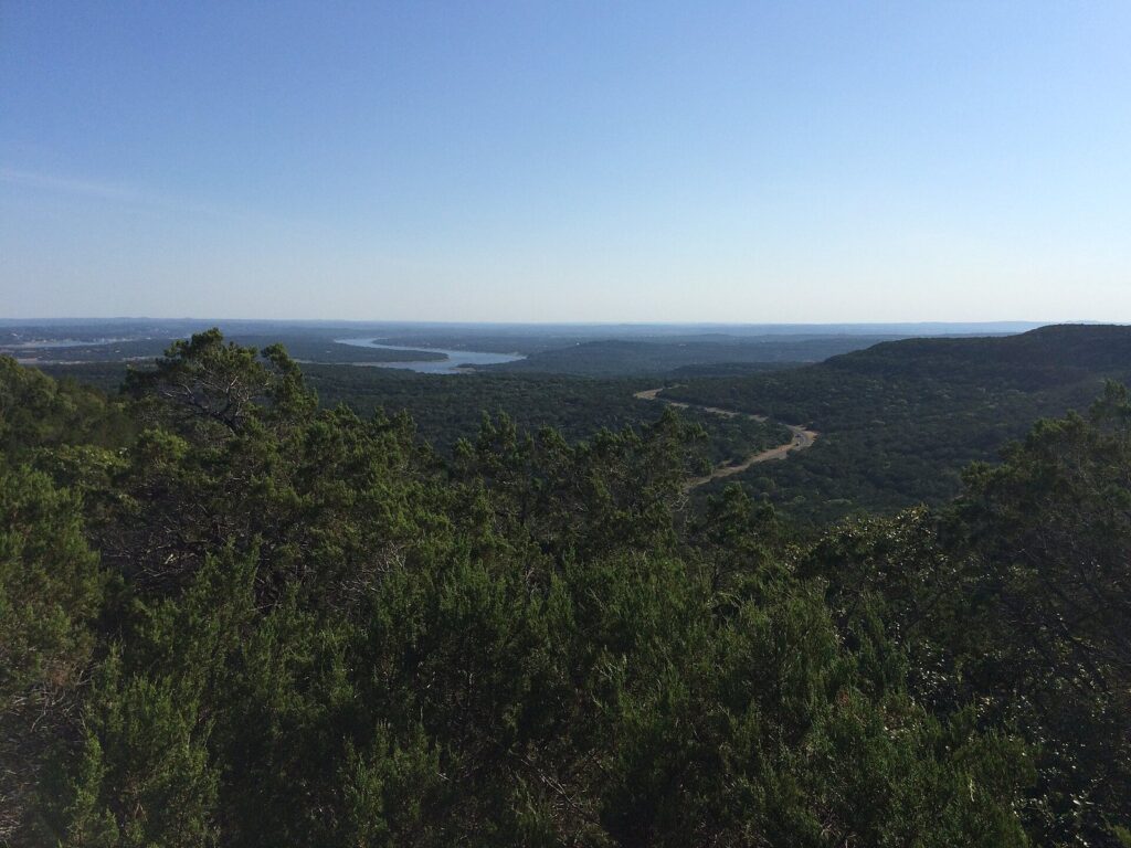
Northwest of Austin, about an hour’s drive, the U.S. Fish and Wildlife Service protects the nesting grounds of the endangered golden-cheeked warbler and the black-capped vireo. The refuge charges no fees. Its Doeskin Ranch area is open every day from dawn to dusk, with about 5 miles of trails, including two easy half-mile loops, one of them half paved. For golden-cheeked warblers, go to Warbler Vista in spring or early summer, early in the morning. For a longer Hill Country outing, pair it with one of our day trips from Austin.
More trails worth knowing
The City’s trail directory lists dozens of trails beyond the famous ones. These are the most useful for visitors, with the City’s own lengths and uses.
| Trail | Length | Use | Why go |
|---|---|---|---|
| Shoal Creek Greenbelt Trail and Sidewalk | 6.82 miles | Hike and bike | An urban creek trail from the lake into central Austin; listed as ADA accessible with an asterisk |
| Lower Bull Creek Greenbelt Trail | 4.05 miles | Hike and bike | Limestone creek scenery in northwest Austin |
| Upper Bull Creek Greenbelt Trail | 2.44 miles | Hike and bike | Quieter continuation of the same creek |
| St. Edwards Greenbelt Trail | 3.59 miles | Hike and bike | Hilly, wooded northwest trail |
| Turkey Creek Trail, Emma Long Metro Park | 1.92 miles | Hike and off-leash dogs | The classic trail for dogs off leash |
| Mary Moore Searight Metro Park Trail | 3.97 miles | Hike and bike | South Austin loop; listed as ADA accessible with an asterisk |
| Roy G Guerrero Colorado River Metro Park Trail | 1.91 miles | Hike and bike | River trail east of downtown |
| Walter E. Long Metro Park Loop Trail | 2.64 miles | Hike and bike | Lakeside loop in far northeast Austin |
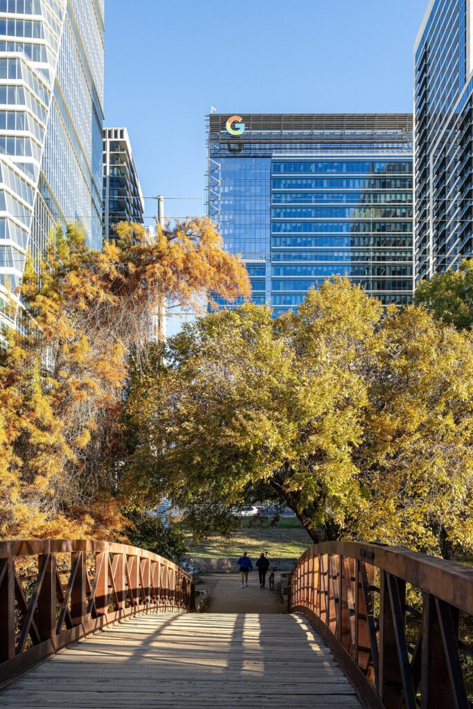
The Violet Crown Trail, a long-distance trail being built by the Hill Country Conservancy with the City, already runs about 13 miles from its Zilker Park trailhead to the Wildflower Center, sharing its first miles with the Greenbelt. A 13-mile extension from Circle C toward Hays County was scheduled to finish in summer 2026; check the conservancy’s site for what’s open before planning a long walk.
What else can you do outdoors in Austin?
Rock climbing
The limestone walls along the Barton Creek Greenbelt are Austin’s home crags, reached from the same trailheads hikers use. There are no rentals, guides or services on site, so climb with experienced partners or through a local gym’s outdoor program, wear a helmet, and remember that limestone can break. Summer rock bakes in the afternoon sun; spring and fall mornings are the season.
Disc golf
Zilker Park has a disc golf course, and the City kept it open through ACL setup this fall. Bring your own discs, watch for walkers crossing the fairways, and go early on summer days.
Paddling
Lady Bird Lake bans gas-powered boats, which keeps the water calm for kayaks, canoes and paddleboards. Walk-up rentals start at $15 an hour for a single kayak at Texas Rowing Center, and paddling to the Congress Avenue Bridge at dusk is a memorable way to see the bats.
Birdwatching
Spring is the season. The endangered golden-cheeked warbler nests at Balcones Canyonlands, where the refuge suggests Warbler Vista and early mornings. Closer in, quiet preserves such as Wild Basin and the wooded creek trails at McKinney Falls and Bull Creek are good for a dawn walk with binoculars, and the peafowl at Mayfield Park are guaranteed, if not exactly wild.
Gardens and outdoor art
The 28-acre Zilker Botanical Garden ($8 for non-resident adults) and the UMLAUF Sculpture Garden ($8) sit side by side near Barton Springs, and both close on ACL weekends. The Wildflower Center’s Fortlandia fills its grounds with designer forts each fall.
How do you enjoy the outdoors in an Austin summer?
Carefully, and early. The numbers explain why. At Camp Mabry, the city’s official weather station, the average high is 96.6°F in July and 97.8°F in August, and Austin averages about 29 days a year at or above 100°F, 13 of them in August. The first 100-degree day usually comes around July 9, and in 2011 the city logged a record 90 of them. Gulf humidity can push the heat index above 110.
- Start at first light. City parks open at 5 a.m., and the Butler Trail’s boardwalk does too. By 10 a.m. in July, the best of the day is gone.
- Choose shade and water. The Greenbelt, Bull Creek and McKinney Falls have tree cover and creeks; Mount Bonnell, the Veloway and much of the lake trail don’t.
- Carry more water than seems reasonable, and salty snacks on longer hikes. Trailheads rarely have drinking water, and Hamilton Pool has none.
- Know the warning signs. Dizziness, headache, nausea, cramps or confusion mean stop, get into shade, cool down and drink. Confusion or collapse means call 911.
- Mind your dog’s paws. Pavement and bare limestone get hot enough to burn in summer sun, and dogs overheat faster than people.
- Swap the hike for a swim. Barton Springs holds around 68 to 70 degrees all year, and a midday swim beats a midday hike every time.
The best months for hiking are October and November and March through May, when highs sit in the 70s and 80s. Winter is mild, with January highs in the low 60s, and trails are quiet. Our guide to the best time to visit Austin goes month by month.
How do you check trail conditions before you go?
Austin’s outdoors can change overnight: a storm floods a creek crossing, a festival closes a lot, a drought dries a swimming hole. A few minutes of checking saves a wasted drive.
- City parks: the City’s parks closures page, at AustinTexas.gov/ParkClosures, lists closures and trail detours. It’s where the Butler Trail detours and ACL closures are posted.
- Barton Creek: the City doesn’t monitor Greenbelt water levels; it points visitors to the USGS and LCRA Hydromet gauges on Barton Creek.
- State parks: each Texas Parks and Wildlife park page has an alerts box for burn bans, capacity and closures, and McKinney Falls asks you to call about creek conditions.
- Travis County parks: Hamilton Pool’s status line, 512-854-2581, is updated by 8:30 a.m. daily; the county’s news page lists burn bans and park closures.
- After heavy rain: give dirt trails a day or two to drain. Muddy trails get rutted, and creek crossings can be dangerous even when the sky is clear.
What should you know about trail safety and etiquette?
- Floods come fast. Creek crossings on the Greenbelt and Bull Creek can go from ankle-deep to dangerous after upstream rain. If water is rising, muddy or moving fast, turn back.
- Watch where you step. Central Texas trails have rattlesnakes, fire ants and poison ivy. Stay on the trail and look before you put a hand on a ledge.
- Carry a light. The Greenbelt has little or no lighting, and City park facilities close at 10 p.m.
- Pack it out. On the Greenbelt, trash cans sit only at trailheads.
- Share the trail. On shared hike-and-bike trails, riders slow down and call out before passing; walkers keep right.
- No fires or drones where banned. Burn bans cover McKinney Falls and Travis County parks, the Wildflower Center bans drones, and bat groups ask drone pilots to stay well clear of the emerging colony.
Which outdoor spots are accessible?
Austin’s rugged limestone trails aren’t built for wheelchairs, but several good options are. The City’s trail directory marks three of its trails as ADA accessible, each with an asterisk, so check the details before you go: the Butler Trail around Lady Bird Lake, the Shoal Creek Greenbelt Trail and Sidewalk, and the Mary Moore Searight Metro Park Trail. The City’s downloadable trail PDF lists surfaces.
- Butler Trail boardwalk: the roughly 1.3-mile boardwalk on the south shore of Lady Bird Lake is the smoothest stretch of the lake loop.
- Violet Crown Trail’s Mile Zero trailhead: the new Zilker Park entrance added a stabilized trail and improved accessible access in 2025.
- Doeskin Ranch: at Balcones Canyonlands, one of the two easy half-mile loops is half paved.
- Capitol grounds: the shaded Capitol grounds are an easy, flat outdoor stroll, and the building’s accessible entrance is on the north side, with wheelchairs available at the Tour Guide office.
Where can you take a dog outdoors in Austin?
Plenty of places, with some notable exceptions. The Turkey Creek Trail at Emma Long Metropolitan Park and the Mary Moore Searight Off-Leash Trail (1.22 miles) are designated off-leash trails. On the Greenbelt, dogs are welcome on a leash of 6 feet or less. Leave dogs at home for Wild Basin, Mayfield Park, Hamilton Pool and Barton Springs, all of which ban pets, and the Wildflower Center, which allows service dogs only. At McKinney Falls, pets aren’t allowed in the water at the Upper and Lower Falls, and Texas Parks and Wildlife’s screwworm alert asks owners to check their animals often. Keep dogs out of lake water with algae mats, especially around Red Bud Isle on Lady Bird Lake, where the City reported them this summer.
What are the best outdoor activities in Austin for kids?
Zilker Park is the family hub, with the Zilker Eagle mini train ($6 plus tax, under 2 free), the playscape, picnic lawns and Barton Springs a short walk away. The Veloway’s car-free loop is the safest place in the city for a child on a bike or skates. Mayfield Park’s peacocks delight small kids, as long as nobody chases them, and the bats at sunset impress everyone. McKinney Falls is free for kids 12 and under, and the Wildflower Center charges $9 to $12 for youth aged 3 to 17, with children 2 and under free. Our guide to Austin with kids has full family itineraries.
What are the seasonal highlights?
| Season | Highlights | Watch out for |
|---|---|---|
| Spring (March to May) | Bluebonnets and wildflowers, flowing creeks on the Greenbelt, the bats returning, warblers at Balcones Canyonlands | Spring storms and flash floods; paid parking at Zilker starts at spring break |
| Summer (June to August) | Barton Springs, sunrise runs, bats at sunset | Highs near 97°F and about 29 days a year over 100°F |
| Fall (September to November) | Cooler hikes, ACL Festival, Wildflower Center evenings, the last bat flights | Festival closures in Zilker; lake drawdowns |
| Winter (December to February) | Quiet trails, mild days in the 60s, year-round swimming at Barton Springs | Occasional hard freezes and ice |
How do you get to Austin’s parks and trails?
Central spots don’t need a car. The Butler Trail starts downtown, CapMetro Route 30 stops at Barton Springs in Zilker Park, and bikeshare covers the lake and Zilker. For Mount Bonnell, Mayfield Park, Wild Basin, the Wildflower Center, the Veloway, Walnut Creek and McKinney Falls, a car or rideshare is far easier. Parking is free at many City trailheads, with exceptions: Zilker’s weekend fees in season and paid street parking at the Greenbelt’s Trail’s End entrance. For the bigger picture of fitting the outdoors into a trip, our list of things to do in Austin ranks the city’s sights, and our guide to Austin on a budget shows how many of them are free.
Three outdoor days in Austin
| Car-free city day | Hill Country morning | Day with a dog | |
|---|---|---|---|
| Early morning | Sunrise walk on the Butler Trail from the Congress Avenue Bridge | McKinney Falls when the gate opens at 8 a.m. (reserve on weekends) | The off-leash Turkey Creek Trail at Emma Long Metropolitan Park |
| Late morning | A swim at Barton Springs ($9) | Wild Basin’s trails (free on weekdays) | The Greenbelt on a 6-foot leash, if the creek is running |
| Afternoon | Zilker Botanical Garden ($8), then shade | The Wildflower Center ($15 to $18), then a spin on the Veloway next door | Rest in the shade; pavement is too hot for paws on summer afternoons |
| Evening | The bats at the Congress Avenue Bridge | Sunset from Mount Bonnell | An evening walk on the Butler Trail with your dog on a leash |
Austin outdoor activities FAQ
What is the best hike in Austin?
The Barton Creek Greenbelt, a limestone canyon with 12.68 miles of trail running from Zilker Park into the southwest hills. It’s best in spring or fall, ideally after rain, when the swimming holes run. For something easier and more scenic, walk the 10-mile Butler Trail around Lady Bird Lake; for a quick view, climb Mount Bonnell’s stairs at sunset.
Is it too hot to hike in Austin in summer?
Not if you go early. Normal highs stay at or above 90°F from late May to late September, with August averaging almost 98°F, so hike at sunrise, choose shaded creek trails like the Greenbelt or Bull Creek, carry plenty of water, and finish by midmorning. Spend the hot afternoon at Barton Springs Pool.
Where can you bike in Austin?
The Veloway at Circle C Ranch Metropolitan Park is a 3.11-mile paved loop for bikes and skates only. Walnut Creek Metropolitan Park in north Austin has more than 15 miles of shared dirt trails. The Butler Trail allows bikes but is crowded, so ride slowly. CapMetro Bikeshare rents e-bikes for $10 a day.
Do you need a reservation for Austin parks?
For some. McKinney Falls and Pedernales Falls state parks often sell out, so reserve day passes, especially on weekends. Wild Basin requires reservations on weekends and federal holidays, and Hamilton Pool requires one every day. City parks such as Zilker Park, Mount Bonnell and the Butler Trail don’t need reservations.
Is Mount Bonnell free?
The City lists no fee for Mount Bonnell, in Covert Park at 3800 Mount Bonnell Road, and it’s open daily from 5 a.m. to 10 p.m. A short, steep staircase leads to the top, with views over Lake Austin. During the October 12 to November 30, 2026 drawdown, the lake below will be lower than usual.
Where can I see wildflowers in Austin?
The Lady Bird Johnson Wildflower Center, 284 acres of native gardens in southwest Austin, is the best single place, especially in spring when bluebonnets peak. Admission is $15 on weekdays and $18 on weekends for adults, credit cards only. Parks and roadsides across the Hill Country bloom from March into April in a good year.
Where can you see the Pennybacker Bridge?
Not from the cliff-top overlook on Loop 360, which has no official parking or managed access; TxDOT roadwork there runs into late 2029 and will remove the shoulders people park on. See it from Mount Bonnell, from a boat on Lake Austin, or from Travis County’s Loop 360 Boat Ramp park beneath the bridge’s south end, which has very limited parking.
Related Austin Guides
- Austin Swimming Holes and Lakes: pools, creeks, paddling and water safety.
- Best Time to Visit Austin: when the heat breaks and the wildflowers bloom.
- Day Trips from Austin: the Hill Country beyond the city trails.
- Austin with Kids: parks, trains and playscapes for families.
- Getting Around Austin: bikeshare, buses and trailhead parking.
Sources and verification
Trail lengths, hours, fees, reservation rules, closures and climate figures in this guide were checked on September 23, 2026 against the agencies and operators listed below. The guide is compiled from these official sources rather than from other travel lists, and it doesn’t claim first-hand visits. Trail and water conditions change quickly, so check the operator’s page on the day.
- City of Austin: Trail directory, Butler Trail and Boardwalk, Barton Creek Greenbelt, Historic parks (Mount Bonnell), Zilker Metropolitan Park, Mayfield Park, Violet Crown Trail, Parks closures, Algae in Austin’s waterways
- Texas Parks and Wildlife Department: McKinney Falls State Park, Pedernales Falls State Park
- Travis County Parks: Hamilton Pool Preserve, Loop 360 Boat Ramp, Parks news and burn bans
- U.S. Fish and Wildlife Service: Balcones Canyonlands National Wildlife Refuge, Refuge trails
- Preserves and gardens: Wild Basin Wilderness Preserve (St. Edward’s University), Lady Bird Johnson Wildflower Center, Zilker Botanical Garden, UMLAUF Sculpture Garden, Zilker Eagle, Hill Country Conservancy
- Weather and climate: National Weather Service Austin/San Antonio, NOAA National Centers for Environmental Information (1991-2020 normals)
- Roads and transit: TxDOT (Loop 360 projects), CapMetro Bikeshare, Texas Capitol accessibility
- Bats: Bat Conservation International, Merlin Tuttle’s Bat Conservation
Photo credits
- Pfluger Pedestrian Bridge on the Butler Trail: photo by Sk5893, Wikimedia Commons (CC BY-SA 4.0)
- View from Mount Bonnell, 2016: photo by Spawnzilla, Wikimedia Commons (CC BY-SA 4.0)
- Waterfall at Wild Basin Wilderness Preserve, 2016: photo by Larry D. Moore, Wikimedia Commons (CC BY 4.0)
- Bluebonnets at the Lady Bird Johnson Wildflower Center: photo by Larry D. Moore, Wikimedia Commons (CC BY 4.0)
- Trail in Walnut Creek Metropolitan Park, 2022: photo by Larry D. Moore, Wikimedia Commons (CC BY 4.0)
- Balcones Canyonlands near Lago Vista, 2015: photo by Daniel Ziegler, Wikimedia Commons (CC BY-SA 4.0)
- Shoal Creek Trail bridge, 2025: photo by ajay_suresh, Wikimedia Commons (CC BY 4.0)
- Bull Creek District Park, 2022 (featured image): photo by Larry D. Moore, Wikimedia Commons (CC BY 4.0)